
Yubeng sits in a hidden valley on the flank of the Meili Snow Mountains, under Kawagebo, the highest peak in Yunnan and one of the most sacred mountains in the Tibetan world. It has never been climbed and, out of respect for local belief, climbing it is no longer allowed. You come here to walk around it.
There is no road into the village itself. You walk in over a forested pass, spend a few days making day hikes from two small villages, and walk out down a gorge. It is the best multi-day trek in Yunnan.
The route
Walking in: Xidang to Upper Yubeng. From the trailhead near Xidang hot springs, a broad path climbs through pine and oak forest to the Nazongla Pass at about 3,700 m. Horses can carry you or your bags up this section. From the prayer flags on the pass, the trail drops into the valley to Upper Yubeng.
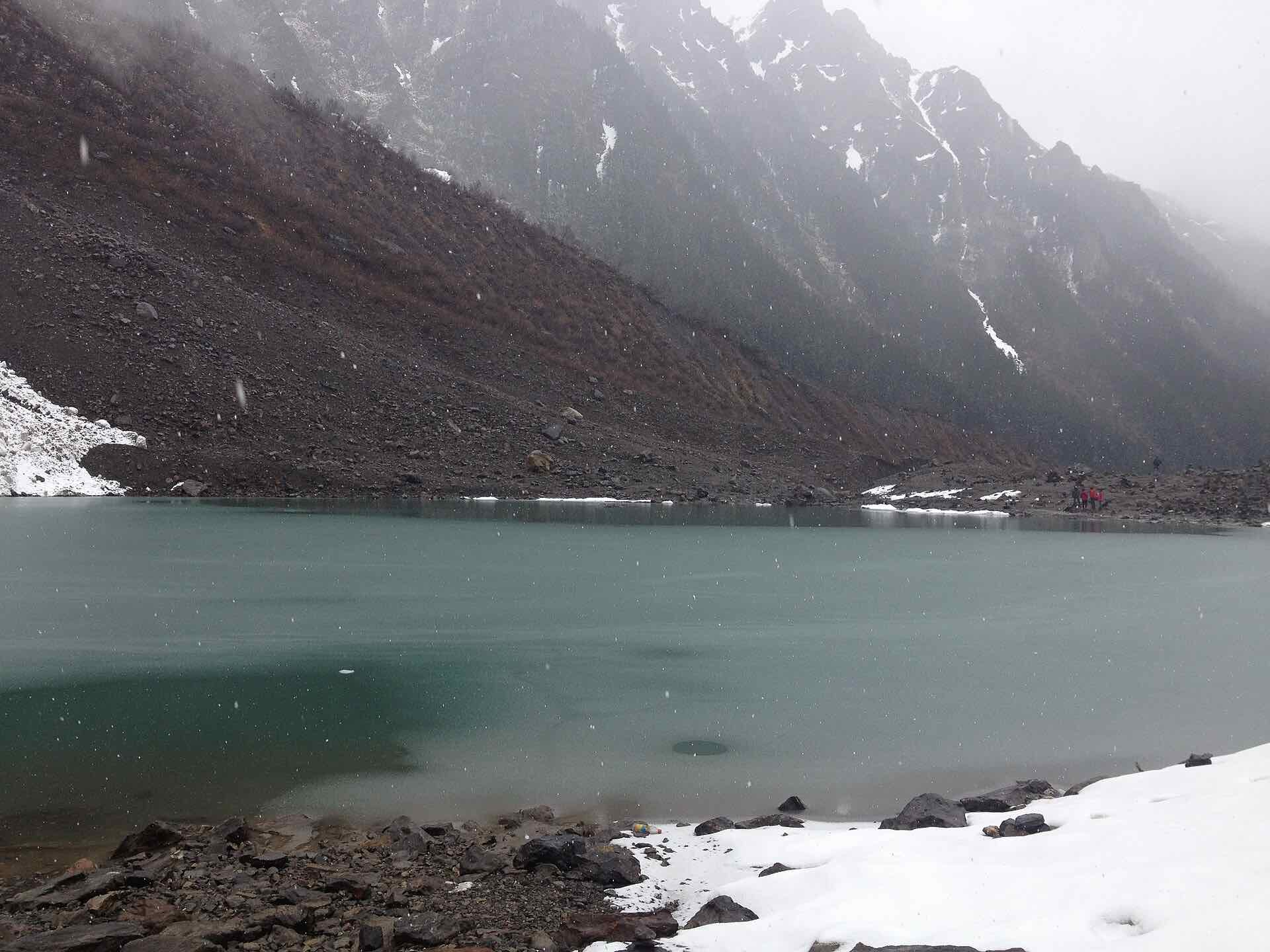
Ice Lake. A full day from Upper Yubeng up through old forest and alpine meadows to a glacial lake beneath the ice falls of the Meili range. It is the highest point of the trek and the best view of the glaciers.
Sacred Waterfall. From Lower Yubeng, a pilgrim path climbs a gorge to a waterfall that falls from the glaciers above. Tibetan pilgrims walk through its spray for a blessing. Expect prayer flags, mani stones and, in season, pilgrims walking clockwise around the sacred sites.
Walking out: the Ninong gorge. Most people leave by the Ninong path, which follows the Yubeng river down a dramatic gorge to Ninong village, where vehicles meet you.
When to go
April to June brings rhododendrons and green meadows. October and November have the clearest skies, and that is when you are most likely to see Kawagebo turn gold at sunrise. July and August are wet and the mountains hide in cloud. Winter is cold and the pass can be snowbound.
Guided or self-guided?
Experienced trekkers can walk Yubeng independently. Most visitors still benefit from a guide or at least booked logistics. The trailheads are a long drive from Shangri-La, the tickets and horses are arranged in Chinese, and a local guide turns the sacred sites from scenery into stories. If you go self-guided, we can arrange the car, rooms and horses.
Stage by stage
| Stage | Distance | Time | Up / down | Overnight |
|---|---|---|---|---|
| Xidang → Nazongla Pass → Upper Yubeng | 13 km | 5–6 h | +950 / −500 m | 3,200 m |
| Upper Yubeng → Ice Lake → Upper Yubeng | 12 km | 6–7 h | +650 / −650 m | 3,200 m |
| Upper → Lower Yubeng → Sacred Waterfall → Lower Yubeng | 13 km | 5–6 h | +600 / −700 m | 3,100 m |
| Lower Yubeng → Ninong gorge → Ninong | 12 km | 4–5 h | +150 / −1150 m | — |
Elevation profile
Route map
Route map coming soon.
We only publish tracks we have walked or licensed ourselves.
Practical information
The things Chinese-language guides rarely cover: what changes when you travel on a foreign passport.
- Access for foreigners
- Yubeng is in Yunnan province, not the Tibet Autonomous Region, and does not need a Tibet permit. Access rules in Tibetan areas can change at short notice, so we check before every trip.
- Tickets
- A Meili Snow Mountain scenic-area ticket is checked on the way in. Bring your passport.
- Paying
- Guesthouses and horse handlers take WeChat Pay and Alipay, but signal on the trails is patchy. Carry enough cash for horses and a night's lodging.
- Altitude
- Upper Yubeng sleeps at about 3,200 m and Ice Lake reaches about 3,850 m. Spend at least one night at Shangri-La or Feilaisi before you walk in.
- Etiquette
- Kawagebo is one of the holiest mountains in Tibetan Buddhism. Walk clockwise around stupas and mani stones, never climb on them, and ask before photographing people.
- Registration
- Guesthouses must register your passport. Check that yours accepts foreign guests before you arrive.
- Language
- Little English is spoken in the villages and menus are often Chinese-only. A translation app with an offline Chinese pack helps.
- Winter
- Snow can close the Nazongla pass in winter. The Ninong gorge path is the usual alternative way in and out.